ZCZC MIATWOEP ALL
TTAA00 KNHC DDHHMM
Tropical Weather Outlook
NWS National Hurricane Center Miami FL
500 PM PDT Sun Jul 2 2017
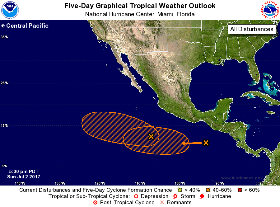
For the eastern North Pacific...east of 140 degrees west longitude:
1. A broad area of low pressure located several hundred miles to the
south-southwest of Manzanillo, Mexico, continues to produce showers
and thunderstorms. Gradual development of this system is possible
during the next several days while it moves west-northwestward away
from the coast of southwestern Mexico.
* Formation chance through 48 hours...low...20 percent.
* Formation chance through 5 days...medium...40 percent.
2. A tropical wave located south of the southeastern coast of Mexico
is producing a few disorganized showers and thunderstorms. A low
pressure system is expected to form well south of the coast of
Mexico in association with the wave during the next few days.
Environmental conditions are forecast to be favorable for
development of this system by later this week while it moves
generally westward around 10 mph.
* Formation chance through 48 hours...low...near 0 percent.
* Formation chance through 5 days...medium...60 percent.
Forecaster Zelinsky