ZCZC MIATWOEP ALL
TTAA00 KNHC DDHHMM
Tropical Weather Outlook
NWS National Hurricane Center Miami FL
500 PM PDT Fri Jun 23 2017
For the eastern North Pacific...east of 140 degrees west longitude:
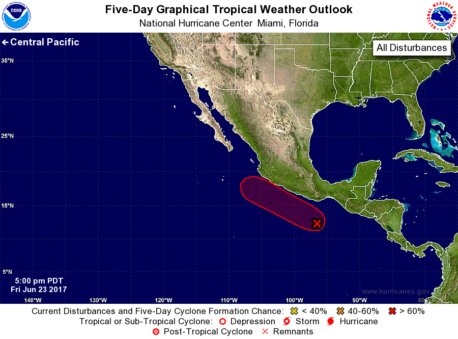
1. Satellite images indicate that the low pressure system centered a
couple of hundred miles south of Puerto Angel, Mexico, is
developing a well-defined center of circulation, and the associated
shower and thunderstorm activity continues to show signs of
organization. Environmental conditions are conducive for
additional development, and a tropical depression is expected to
form during the next day or two while the low moves
west-northwestward at 10 mph parallel to the coast of Mexico.
Heavy rains are possible in the Mexican states of Oaxaca and
Guerrero during the next couple of days, and interests along the
southwestern coast of Mexico should monitor the progress of this
system.
* Formation chance through 48 hours...high...80 percent.
* Formation chance through 5 days...high...90 percent.
Forecaster Berg