ZCZC MIATWOEP ALL
TTAA00 KNHC DDHHMM
Tropical Weather Outlook
NWS National Hurricane Center Miami FL
1100 PM PDT Tue May 30 2017
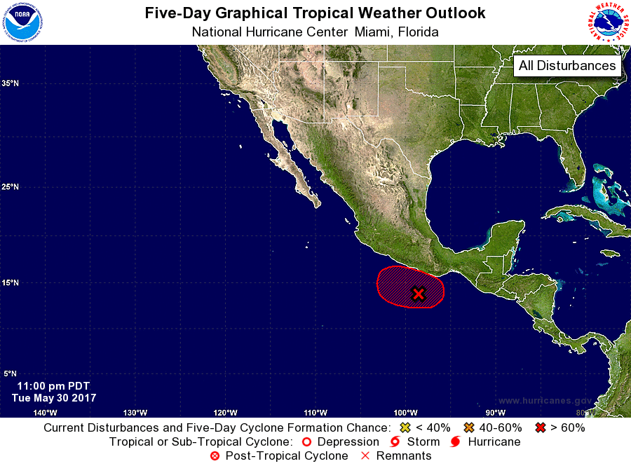
For the eastern North Pacific...east of 140 degrees west longitude:
1. Showers and thunderstorms associated with a low pressure area
located about 275 miles southeast of Acapulco, Mexico, have changed
little in organization this evening. Conditions are expected to be
conducive for development, and a tropical depression is likely to
form on Wednesday or Thursday while the low drifts northward toward
the coast of Mexico. Regardless of development, locally heavy rains
are expected to spread over the coast of southeastern and southern
Mexico during the next several days. These rains could cause
life-threatening flash floods and mudslides.
* Formation chance through 48 hours...high...70 percent.
* Formation chance through 5 days...high...80 percent.
Forecaster Brown