ZCZC MIATWOEP ALL
TTAA00 KNHC DDHHMM
Special Tropical Weather Outlook
NWS National Hurricane Center Miami FL
830 PM PDT Mon May 8 2017
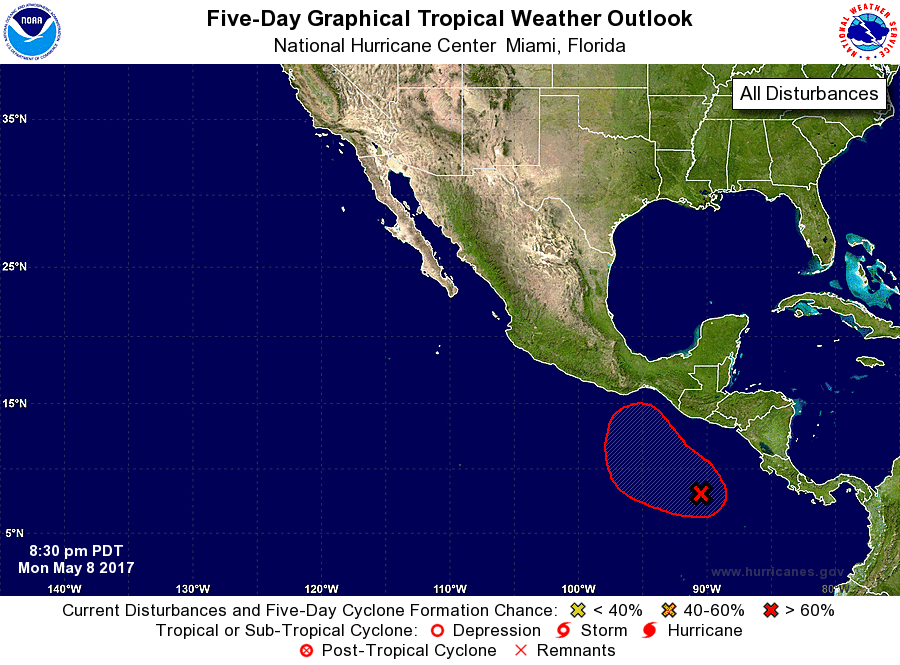
For the eastern North Pacific...east of 140 degrees west longitude:
1. A broad area of low pressure is located a few hundred miles south
of El Salvador. Shower and thunderstorm activity is showing signs
of organization, and environmental conditions are expected to be
favorable for a tropical depression to form during the next day
or so. The low is forecast to move slowly toward the west-northwest
or northwest, remaining well offshore of the coasts of Central
America and southeastern Mexico through at least Thursday. The
next Special Tropical Weather Outlook on this system will be issued
by 12 PM PDT Tuesday.
* Formation chance through 48 hours...high...70 percent.
* Formation chance through 5 days...high...90 percent.
Forecaster Stewart