ZCZC MIATWOEP ALL
TTAA00 KNHC DDHHMM
TROPICAL WEATHER OUTLOOK
NWS NATIONAL HURRICANE CENTER MIAMI FL
1100 AM PDT THU SEP 29 2016
For the eastern North Pacific...east of 140 degrees west longitude:
The National Hurricane Center has issued the last advisory on
Roslyn, which has become a post-tropical cyclone located a few
hundred miles west of the southern tip of the Baja California
peninsula. The National Hurricane Center has issued its last
advisory on Tropical Storm Ulika, located well to the east-southeast
of the Hawaiian Islands. Subsequent advisories on this system will
be issued by the Central Pacific Hurricane Center in Honolulu,
Hawaii.
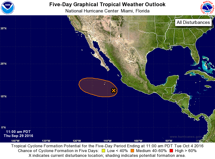
1. Cloudiness and showers extending several hundred miles off the
southwestern coast of Mexico are associated with a trough of low
pressure. Upper-level winds are expected to be marginally conducive
for some development during the next several days while this system
moves westward to west-northwestward at 10 mph away from the coast
of Mexico. By late this weekend, this system is forecast to
encounter cooler waters, making development less likely.
* Formation chance through 48 hours...low...20 percent
* Formation chance through 5 days...medium...40 percent
Forecaster Pasch