ZCZC MIATWOEP ALL
TTAA00 KNHC DDHHMM
TROPICAL WEATHER OUTLOOK
NWS NATIONAL HURRICANE CENTER MIAMI FL
500 PM PDT MON SEP 5 2016
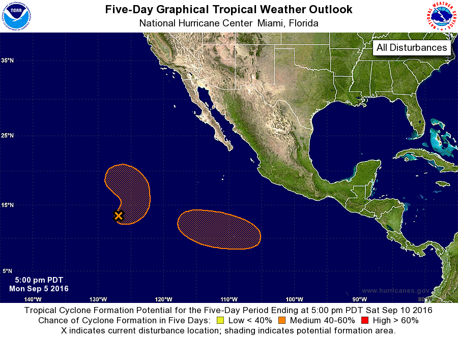
For the eastern North Pacific...east of 140 degrees west longitude:
The National Hurricane Center is issuing advisories on recently
upgraded Hurricane Newton, located south-southeast of Cabo San
Lucas, Mexico.
1. Shower activity associated with an elongated area of low pressure
located about 1300 miles west-southwest of the southern tip of the
Baja California peninsula has changed little in organization today.
Environmental conditions are expected to be conducive for some
development of this system during the next few days while it drifts
eastward, and then turns northward later in the week.
* Formation chance through 48 hours...medium...40 percent
* Formation chance through 5 days...medium...50 percent
2. An area of low pressure is expected to form later this week several
hundred miles southwest of Manzanillo, Mexico. Slow development of
this system is possible after that time while it moves westward or
west-northwestward.
* Formation chance through 48 hours...low...near 0 percent
* Formation chance through 5 days...medium...40 percent
Forecaster Brown