ZCZC MIATWOEP ALL
TTAA00 KNHC DDHHMM
TROPICAL WEATHER OUTLOOK
NWS NATIONAL HURRICANE CENTER MIAMI FL
500 PM PDT SAT AUG 6 2016
For the eastern North Pacific...east of 140 degrees west longitude:
The National Hurricane Center is issuing advisories on Tropical
Storm Ivette, located about 1300 miles east of the Hawaiian Islands.
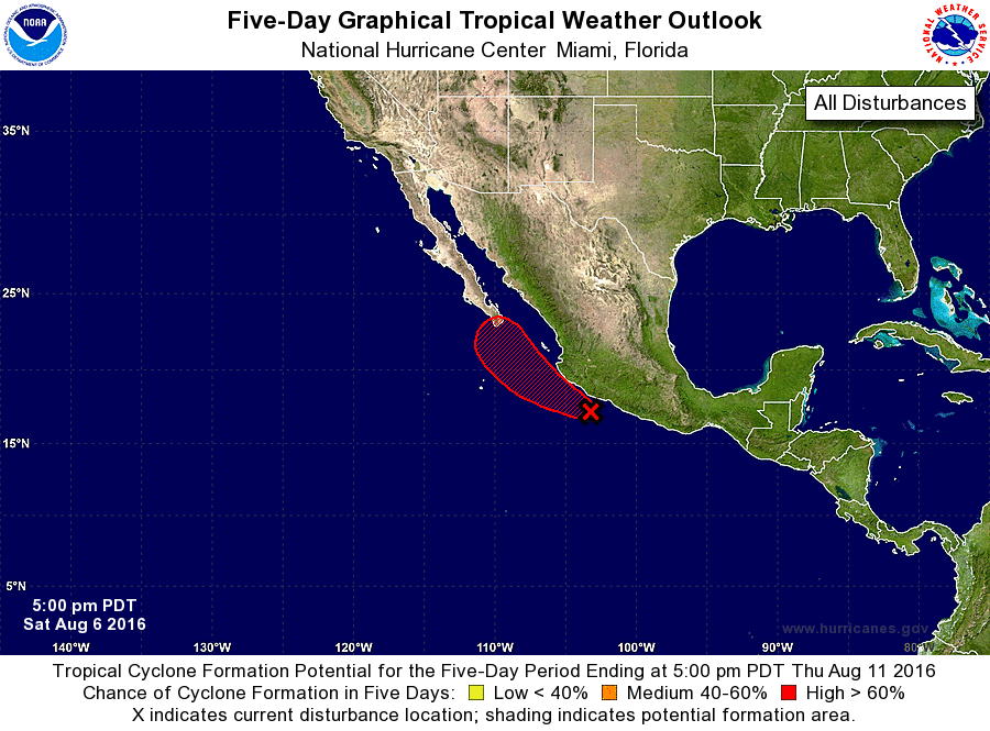
1. Showers and thunderstorms associated with a low pressure area about
150 miles south-southeast of Manzanillo, Mexico, are gradually
becoming better organized. Although there is no indication of a
well-defined circulation yet, surface pressures have fallen
significantly across this region during the last 24 hours. If
these trends continue, a tropical depression is likely to form
tonight or Sunday while the low moves west-northwestward to
northwestward near the southwestern coast of Mexico toward the
southern Baja California peninsula. Interests in these areas should
monitor the progress of this system.
* Formation chance through 48 hours...high...90 percent
* Formation chance through 5 days...high...90 percent
Forecaster Kimberlain