ZCZC MIATWOEP ALL
TTAA00 KNHC DDHHMM
TROPICAL WEATHER OUTLOOK
NWS NATIONAL HURRICANE CENTER MIAMI FL
1100 AM PDT SAT AUG 6 2016
For the eastern North Pacific...east of 140 degrees west longitude:
The National Hurricane Center is issuing advisories on Tropical
Storm Ivette, located about 1350 miles east of the Hawaiian Islands.
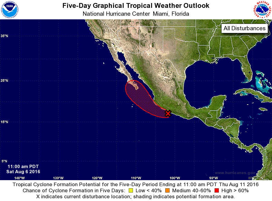
1. A broad area of low pressure has formed near the southwestern coast
of Mexico and is producing disorganized showers and thunderstorms
that extend from the Gulf of Tehuantepec northwestward to near
Manzanillo. Additional development of this system is anticipated,
and a tropical depression is expected to form over the next day or
two while the low moves west-northwestward to northwestward at 10 to
15 mph. Interests along the southwestern coast of Mexico and
southern portions of the Baja California peninsula should monitor
the progress of this system during the next few days.
* Formation chance through 48 hours...high...80 percent
* Formation chance through 5 days...high...90 percent
Forecaster Berg