ZCZC MIATWOEP ALL
TTAA00 KNHC DDHHMM
TROPICAL WEATHER OUTLOOK
NWS NATIONAL HURRICANE CENTER MIAMI FL
1100 AM PDT SUN JUL 10 2016
For the eastern North Pacific...east of 140 degrees west longitude:
The National Hurricane Center is issuing advisories on Tropical
Storm Celia, located more than 900 miles southwest of the southern
tip of the Baja California peninsula. The National Hurricane Center
has issued the last advisory on Post-Tropical Cyclone Blas, located
about 1200 miles east of the Big Island of Hawaii.
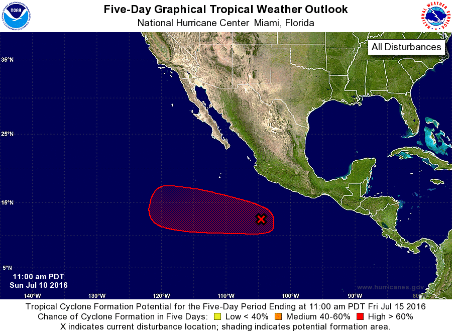
1. Showers and thunderstorms have increased and become a little better
organized in association with a broad area of low pressure located
several hundred miles south of Manzanillo, Mexico. Environmental
conditions appear conducive for continued development of this
system, and a tropical depression is likely to form during the next
couple of days while the low moves west-northwestward to westward at
about 10 mph, away from the coast of Mexico.
* Formation chance through 48 hours...high...70 percent
* Formation chance through 5 days...high...90 percent
Forecaster Stewart