ZCZC MIATWOEP ALL
TTAA00 KNHC DDHHMM
TROPICAL WEATHER OUTLOOK
NWS NATIONAL HURRICANE CENTER MIAMI FL
1100 AM PDT FRI JUL 1 2016
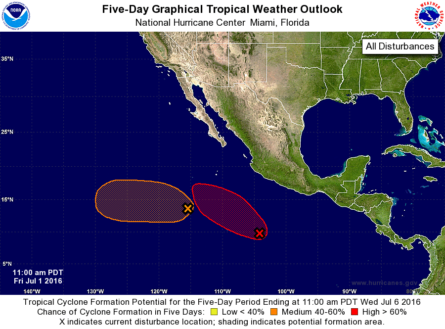
For the eastern North Pacific...east of 140 degrees west longitude:
1. A broad area of low pressure continues several hundred miles south-
southwest of Acapulco, Mexico. The associated shower and
thunderstorm activity is currently disorganized, and only slow
development is expected today and Saturday. After that time,
environmental conditions are forecast to be conducive for a tropical
depression to form while the system moves westward to
west-northwestward at 10 to 15 mph, remaining well offshore of the
coast of Mexico.
* Formation chance through 48 hours...low...30 percent
* Formation chance through 5 days...high...80 percent
2. Satellite imagery this morning indicates that the circulation
associated with the low pressure area several hundred miles
south-southwest of the southern tip of the Baja California peninsula
continues to become better defined. However, the associated shower
activity is currently poorly organized. Some additional development
of this system is possible during the next couple days as it moves
generally west-northwestward at 10 to 15 mph. After that time,
environmental conditions are expected to become less conducive for
development.
* Formation chance through 48 hours...medium...40 percent
* Formation chance through 5 days...medium...40 percent
Forecaster Beven