Skip Navigation Links
NOAA NOAA United States Department of Commerce

NHC Graphical Outlook Archive


« Earliest Available         ‹ Earlier         Later ›         Latest Available »
GIS Shapefiles
tab Eastern North Pacific tab tab Atlantic tab

View 2-Day Graphical Tropical Weather Outlook
Click for Atlantic Click for Atlantic

Tropical Weather Outlook Text

ZCZC MIATWOEP ALL
TTAA00 KNHC DDHHMM

TROPICAL WEATHER OUTLOOK
NWS NATIONAL HURRICANE CENTER MIAMI FL
1100 AM PDT WED JUN 29 2016

For the eastern North Pacific...east of 140 degrees west longitude:

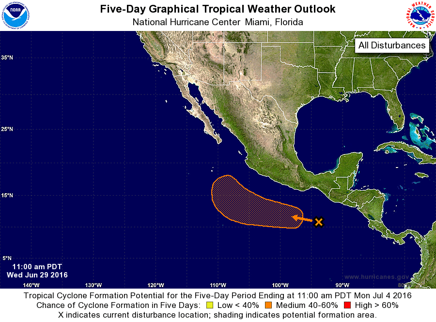
1. A broad area of disturbed weather has developed in association
with a tropical wave several hundred miles south of the Gulf of
Tehuantepec.  A low pressure system is expected to form later this
week, and environmental conditions are forecast to be conducive for
a tropical depression to develop over the weekend while the system
moves generally westward or west-northwestward at 10 to 15 mph,
remaining well offshore of the coast of Mexico.
* Formation chance through 48 hours...low...near 0 percent
* Formation chance through 5 days...medium...60 percent

Forecaster Stewart


List of Atlantic Outlooks (May 2023 - present)
List of East Pacific Outlooks (May 2023 - present)
List of Central Pacific Outlooks (May 2023 - present)
List of Atlantic Outlooks (July 2014 - April 2023)
List of East Pacific Outlooks (July 2014 - April 2023)
List of Central Pacific Outlooks (June 2019 - April 2023)
List of Atlantic Outlooks (June 2009 - June 2014)
List of East Pacific Outlooks (June 2009 - June 2014)