


NHC Graphical Outlook Archive
|
« Earliest Available ‹ Earlier Later › Latest Available » |
GIS Shapefiles |
| Eastern North Pacific | Atlantic |
|
Tropical Weather Outlook Text
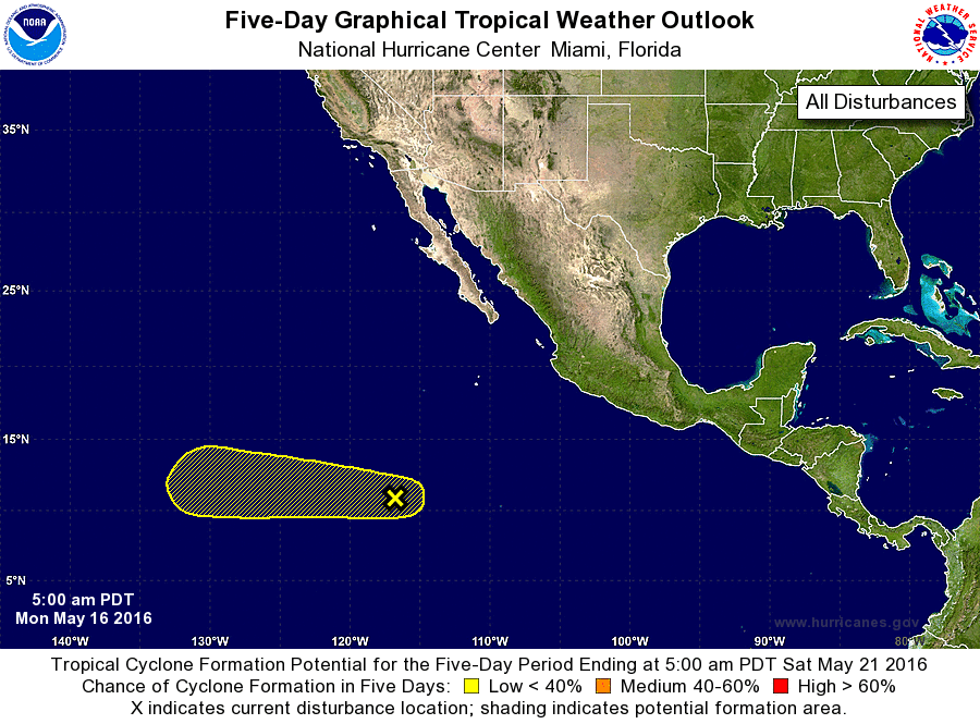
ZCZC MIATWOEP ALL
TTAA00 KNHC DDHHMM

TROPICAL WEATHER OUTLOOK
NWS NATIONAL HURRICANE CENTER MIAMI FL
500 AM PDT MON MAY 16 2016

For the eastern North Pacific...east of 140 degrees west longitude:

1. An area of low pressure located about 950 miles south-southwest of
the southern tip of the Baja California Peninsula has changed
little in organization since yesterday. Some development of this
disturbance is still possible today while it moves westward to
west-northwestward at 5 to 10 mph.  After that time, upper-level
winds are forecast to become unfavorable for tropical cyclone
formation.
* Formation chance through 48 hours...low...20 percent
* Formation chance through 5 days...low...20 percent

Forecaster Avila
List of Atlantic Outlooks (May 2023 - present)
List of East Pacific Outlooks (May 2023 - present)
List of Central Pacific Outlooks (May 2023 - present)
List of Atlantic Outlooks (July 2014 - April 2023)
List of East Pacific Outlooks (July 2014 - April 2023)
List of Central Pacific Outlooks (June 2019 - April 2023)
List of Atlantic Outlooks (June 2009 - June 2014)
List of East Pacific Outlooks (June 2009 - June 2014)