


NHC Graphical Outlook Archive
|
« Earliest Available ‹ Earlier Later › Latest Available » |
GIS Shapefiles |
| Eastern North Pacific | Atlantic |
|
Tropical Weather Outlook Text
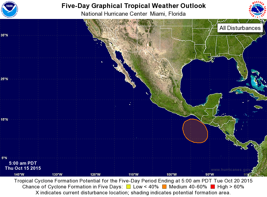
ZCZC MIATWOEP ALL
TTAA00 KNHC DDHHMM

TROPICAL WEATHER OUTLOOK
NWS NATIONAL HURRICANE CENTER MIAMI FL
500 AM PDT THU OCT 15 2015

For the eastern North Pacific...east of 140 degrees west longitude:

The National Hurricane Center is issuing advisories on Tropical
Depression Nineteen-E, located about a thousand miles south-
southwest of the southern tip of the Baja California peninsula.

1. An area of low pressure is expected to form a few hundred miles
south-southeast of the Gulf of Tehuantepec this weekend.  Some
development of this system is anticipated early next week while it
moves slowly northwestward.
* Formation chance through 48 hours...low...near 0 percent
* Formation chance through 5 days...medium...40 percent

Public Advisories on Tropical Depression Nineteen-E are issued under
WMO header WTPZ34 KNHC and under AWIPS header MIATCPEP4.
Forecast/Advisories on the depression are issued under WMO header
WTPZ24 KNHC and under AWIPS header MIATCMEP4.

Forecaster Berg
List of Atlantic Outlooks (May 2023 - present)
List of East Pacific Outlooks (May 2023 - present)
List of Central Pacific Outlooks (May 2023 - present)
List of Atlantic Outlooks (July 2014 - April 2023)
List of East Pacific Outlooks (July 2014 - April 2023)
List of Central Pacific Outlooks (June 2019 - April 2023)
List of Atlantic Outlooks (June 2009 - June 2014)
List of East Pacific Outlooks (June 2009 - June 2014)