


NHC Graphical Outlook Archive
|
« Earliest Available ‹ Earlier Later › Latest Available » |
GIS Shapefiles |
| Eastern North Pacific | Atlantic |
|
Tropical Weather Outlook Text
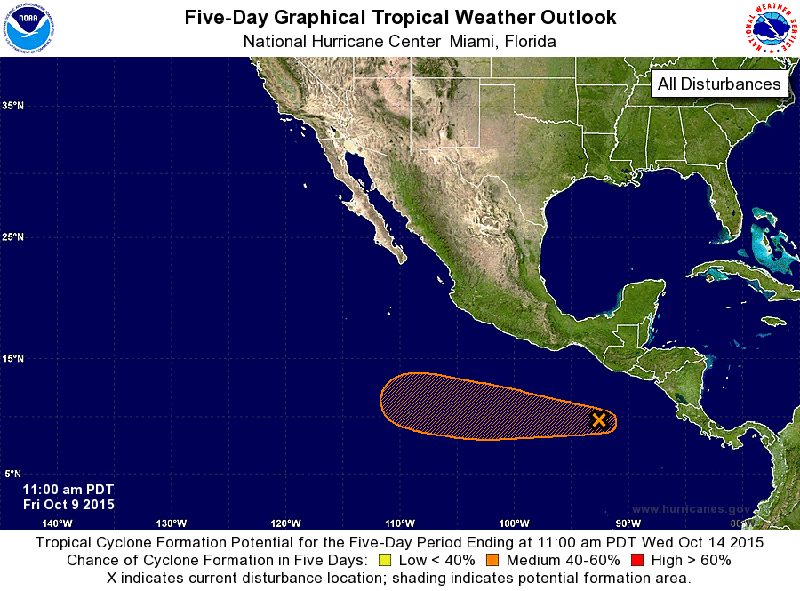
ZCZC MIATWOEP ALL
TTAA00 KNHC DDHHMM

TROPICAL WEATHER OUTLOOK
NWS NATIONAL HURRICANE CENTER MIAMI FL
1100 AM PDT FRI OCT 9 2015

For the eastern North Pacific...east of 140 degrees west longitude:

The National Hurricane Center is issuing advisories on newly formed
Tropical Depression Eighteen-E, located well to the east-southeast
of the Hawaiian Islands.

1. A broad area of low pressure, accompanied by a large area of
disorganized showers and thunderstorms, has formed about 400 miles
south of the Guatemala/Mexico border.  Environmental conditions
are expected to be conducive for development of this system during
the next several days while it moves westward at about 10 mph.
* Formation chance through 48 hours...low...10 percent
* Formation chance through 5 days...medium...50 percent

Public Advisories on Tropical Depression Eighteen-E are issued
under WMO header WTPZ33 KNHC and under AWIPS header MIATCPEP3.
Forecast/Advisories on Tropical Depression Eighteen-E are issued
under WMO header WTPZ23KNHC and under AWIPS header MIATCMEP3.

Forecaster Cangialosi
List of Atlantic Outlooks (May 2023 - present)
List of East Pacific Outlooks (May 2023 - present)
List of Central Pacific Outlooks (May 2023 - present)
List of Atlantic Outlooks (July 2014 - April 2023)
List of East Pacific Outlooks (July 2014 - April 2023)
List of Central Pacific Outlooks (June 2019 - April 2023)
List of Atlantic Outlooks (June 2009 - June 2014)
List of East Pacific Outlooks (June 2009 - June 2014)