


NHC Graphical Outlook Archive
|
« Earliest Available ‹ Earlier Later › Latest Available » |
GIS Shapefiles |
| Eastern North Pacific | Atlantic |
|
Tropical Weather Outlook Text
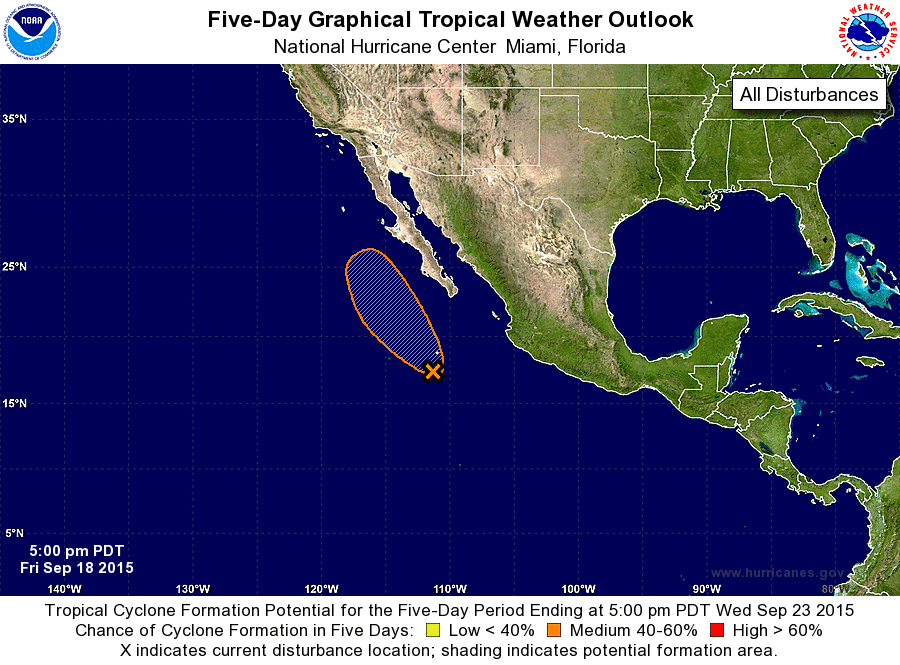
ZCZC MIATWOEP ALL
TTAA00 KNHC DDHHMM

TROPICAL WEATHER OUTLOOK
NWS NATIONAL HURRICANE CENTER MIAMI FL
500 PM PDT FRI SEP 18 2015

For the eastern North Pacific...east of 140 degrees west longitude:

1. Showers and thunderstorms associated with an area of low pressure
located about 400 miles south-southwest of the southern tip of the
Baja California peninsula have increased and become better organized
since yesterday.  Environmental conditions are conducive for
development during the next day or so while this system moves
northwestward or north-northwestward at around 10 mph. After that
time, colder water and strong upper-level winds should prevent
tropical cyclone formation if it has not already occurred.
Regardless of development, moisture from this system could produce
heavy rains and flash flooding across portions of the Baja
California peninsula and northwestern mainland Mexico through the
weekend.
* Formation chance through 48 hours...medium...40 percent
* Formation chance through 5 days...medium...40 percent

Forecaster Kimberlain
List of Atlantic Outlooks (May 2023 - present)
List of East Pacific Outlooks (May 2023 - present)
List of Central Pacific Outlooks (May 2023 - present)
List of Atlantic Outlooks (July 2014 - April 2023)
List of East Pacific Outlooks (July 2014 - April 2023)
List of Central Pacific Outlooks (June 2019 - April 2023)
List of Atlantic Outlooks (June 2009 - June 2014)
List of East Pacific Outlooks (June 2009 - June 2014)