


NHC Graphical Outlook Archive
|
« Earliest Available ‹ Earlier Later › Latest Available » |
GIS Shapefiles |
| Eastern North Pacific | Atlantic |
|
Tropical Weather Outlook Text
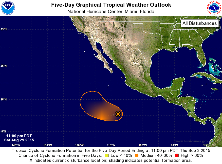
ZCZC MIATWOEP ALL
TTAA00 KNHC DDHHMM

TROPICAL WEATHER OUTLOOK
NWS NATIONAL HURRICANE CENTER MIAMI FL
1100 PM PDT SAT AUG 29 2015

For the eastern North Pacific...east of 140 degrees west longitude:

The National Hurricane Center is issuing advisories on major
Hurricane Jimena, located well west-southwest of the southern tip of
the Baja California peninsula.

1. Shower activity associated with a broad area of low pressure
centered several hundred miles south-southwest of Manzanillo,
Mexico, is gradually becoming better organized. Environmental
conditions are favorable for slow development of this system, and
this disturbance is likely to become a tropical depression by
mid-week while it moves toward the west or west-northwest at about
10 mph.
* Formation chance through 48 hours...low...10 percent
* Formation chance through 5 days...medium...60 percent

Forecaster Blake
List of Atlantic Outlooks (May 2023 - present)
List of East Pacific Outlooks (May 2023 - present)
List of Central Pacific Outlooks (May 2023 - present)
List of Atlantic Outlooks (July 2014 - April 2023)
List of East Pacific Outlooks (July 2014 - April 2023)
List of Central Pacific Outlooks (June 2019 - April 2023)
List of Atlantic Outlooks (June 2009 - June 2014)
List of East Pacific Outlooks (June 2009 - June 2014)