


NHC Graphical Outlook Archive
|
« Earliest Available ‹ Earlier Later › Latest Available » |
GIS Shapefiles |
| Eastern North Pacific | Atlantic |
|
Tropical Weather Outlook Text
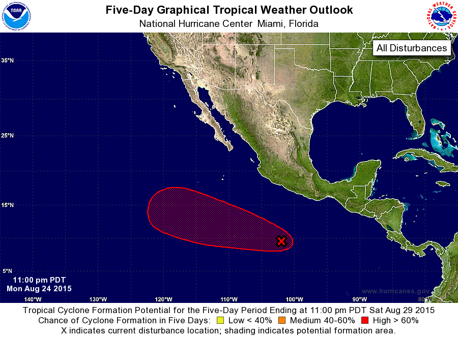
ZCZC MIATWOEP ALL
TTAA00 KNHC DDHHMM

TROPICAL WEATHER OUTLOOK
NWS NATIONAL HURRICANE CENTER MIAMI FL
1100 PM PDT MON AUG 24 2015

For the eastern North Pacific...east of 140 degrees west longitude:

The National Hurricane Center is issuing advisories on newly formed
Tropical Depression Twelve-E, located well east-southeast of the
Hawaiian Islands.

1. A tropical wave continues to produce disorganized showers and
thunderstorms several hundred miles south of the coast of
southwestern Mexico.  Environmental conditions are expected to be
conducive for gradual development of this system, and a tropical
depression is likely to form late this week while it moves
west-northwestward at 10 to 15 mph.
* Formation chance through 48 hours...low...20 percent
* Formation chance through 5 days...high...80 percent

Public Advisories on Twelve-E are issued under WMO header WTPZ32
KNHC and under AWIPS header MIATCPEP2.  Forecast/Advisories are
issued under WMO header WTPZ22 KNHC and under AWIPS header
MIATCMEP2.

Forecaster Cangialosi
List of Atlantic Outlooks (May 2023 - present)
List of East Pacific Outlooks (May 2023 - present)
List of Central Pacific Outlooks (May 2023 - present)
List of Atlantic Outlooks (July 2014 - April 2023)
List of East Pacific Outlooks (July 2014 - April 2023)
List of Central Pacific Outlooks (June 2019 - April 2023)
List of Atlantic Outlooks (June 2009 - June 2014)
List of East Pacific Outlooks (June 2009 - June 2014)