


NHC Graphical Outlook Archive
|
« Earliest Available ‹ Earlier Later › Latest Available » |
GIS Shapefiles |
| Eastern North Pacific | Atlantic |
|
Tropical Weather Outlook Text
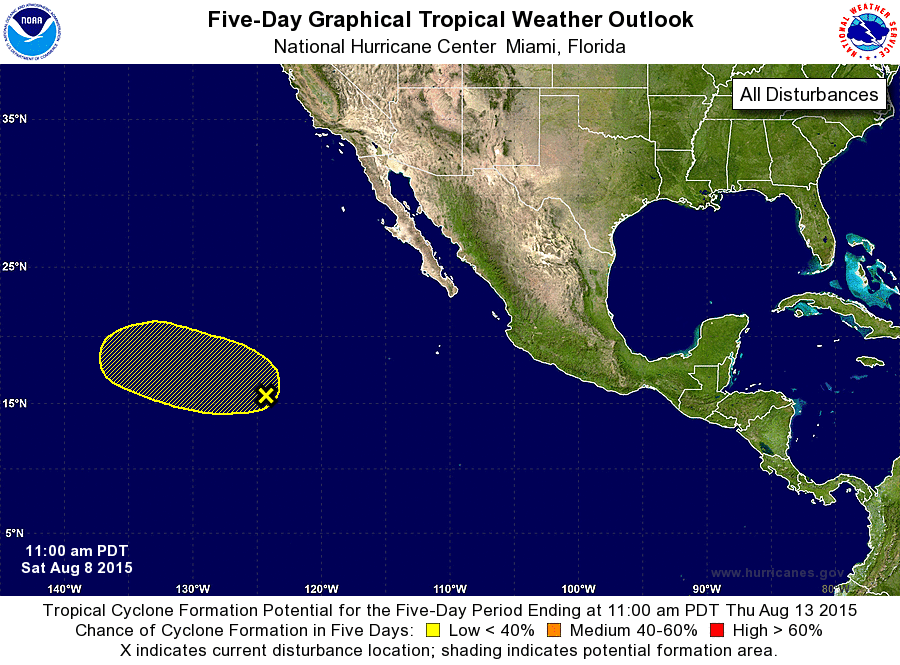
ZCZC MIATWOEP ALL
TTAA00 KNHC DDHHMM

TROPICAL WEATHER OUTLOOK
NWS NATIONAL HURRICANE CENTER MIAMI FL
1100 AM PDT SAT AUG 8 2015

For the eastern North Pacific...east of 140 degrees west longitude:

1. Shower activity associated with a broad trough of low pressure
located about 1000 miles west-southwest of the southern tip of the
Baja California peninsula has become a little better organized since
yesterday.  However, while some development of this system is still
possible during the next day or two, it is more likely that it will
reach cooler water and encounter unfavorable upper-level winds
before becoming a tropical cyclone.
* Formation chance through 48 hours...low...10 percent
* Formation chance through 5 days...low...20 percent

Forecaster Beven
List of Atlantic Outlooks (May 2023 - present)
List of East Pacific Outlooks (May 2023 - present)
List of Central Pacific Outlooks (May 2023 - present)
List of Atlantic Outlooks (July 2014 - April 2023)
List of East Pacific Outlooks (July 2014 - April 2023)
List of Central Pacific Outlooks (June 2019 - April 2023)
List of Atlantic Outlooks (June 2009 - June 2014)
List of East Pacific Outlooks (June 2009 - June 2014)