


NHC Graphical Outlook Archive
|
« Earliest Available ‹ Earlier Later › Latest Available » |
GIS Shapefiles |
| Eastern North Pacific | Atlantic |
|
Tropical Weather Outlook Text
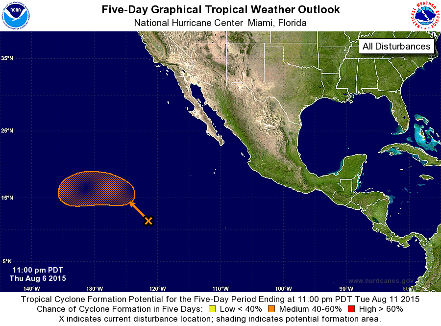
ZCZC MIATWOEP ALL
TTAA00 KNHC DDHHMM

TROPICAL WEATHER OUTLOOK
NWS NATIONAL HURRICANE CENTER MIAMI FL
1100 PM PDT THU AUG 6 2015

For the eastern North Pacific...east of 140 degrees west longitude:

The National Hurricane Center is issuing advisories on Tropical
Storm Hilda, located about 1800 miles west-southwest of the
southern tip of the Baja California peninsula.

1. A broad area of low pressure located more than 1000 miles southwest
of the southern tip of the Baja California peninsula continues to
produce disorganized shower and thunderstorm activity.
Environmental conditions appear conducive for some gradual
development through early next week while this system moves
northwestward to west-northwestward at 5 to 10 mph.
* Formation chance through 48 hours...low...near 0 percent
* Formation chance through 5 days...medium...40 percent

Forecaster Berg
List of Atlantic Outlooks (May 2023 - present)
List of East Pacific Outlooks (May 2023 - present)
List of Central Pacific Outlooks (May 2023 - present)
List of Atlantic Outlooks (July 2014 - April 2023)
List of East Pacific Outlooks (July 2014 - April 2023)
List of Central Pacific Outlooks (June 2019 - April 2023)
List of Atlantic Outlooks (June 2009 - June 2014)
List of East Pacific Outlooks (June 2009 - June 2014)