Skip Navigation Links
NOAA NOAA United States Department of Commerce

NHC Graphical Outlook Archive


« Earliest Available         ‹ Earlier         Later ›         Latest Available »
GIS Shapefiles
Central Pacific Eastern Pacific Atlantic

View 2-Day Graphical Tropical Weather Outlook
Click for Eastern North Pacific Click for Eastern North Pacific

Tropical Weather Outlook Text

ZCZC HFOTWOCP ALL
TTAA00 PHFO DDHHMM

Tropical Weather Outlook
NWS Central Pacific Hurricane Center Honolulu HI
200 PM HST Wed Aug 10 2022

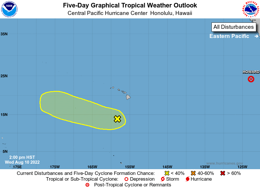
For the central North Pacific...between 140W and 180W:

1. Well south of the main Hawaiian Islands:
A surface low located several hundred miles south of the main 
Hawaiian Islands shows better organization of showers and 
thunderstorms this afternoon. Environmental conditions may allow 
some gradual development of this system as it moves quickly west 
northwest away from the main Hawaiian Islands through the weekend.
* Formation chance through 48 hours...low...10 percent.
* Formation chance through 5 days...low...30 percent.

Elsewhere, no tropical cyclones are expected during the next 5 
days.

Forecaster Foster


List of Atlantic Outlooks (May 2023 - present)
List of East Pacific Outlooks (May 2023 - present)
List of Central Pacific Outlooks (May 2023 - present)
List of Atlantic Outlooks (July 2014 - April 2023)
List of East Pacific Outlooks (July 2014 - April 2023)
List of Central Pacific Outlooks (June 2019 - April 2023)
List of Atlantic Outlooks (June 2009 - June 2014)
List of East Pacific Outlooks (June 2009 - June 2014)