ZCZC HFOTWOCP ALL
TTAA00 PHFO DDHHMM
Tropical Weather Outlook
NWS Central Pacific Hurricane Center Honolulu HI
200 AM HST Thu Aug 5 2021
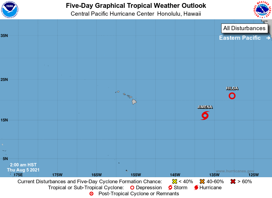
For the central North Pacific...between 140W and 180W:
The National Hurricane Center in Miami, Florida has recently
upgraded Tropical Depression Nine-E to Tropical Storm Jimena.
Jimena, which is currently more than 1200 miles east-southeast
of Hilo, Hawaii, may reach the Central Pacific Hurricane
Center's area of responsibility on Friday based on the latest
forecast. Note that environmental conditions are expected to
become increasingly hostile around the time Jimena crosses
Longitude 140W.
Elsewhere, no tropical cyclones are expected during the next 5
days.
Public advisories on Tropical Storm Jimena are issued under
WMO header WTPZ34 KNHC and AWIPS header MIATCPEP4.
Forecast advisories on Tropical Storm Jimena are issued under
WMO header WTPZ24 KNHC and AWIPS header MIATCMEP4.
$$
Forecaster Houston
NNNN