Skip Navigation Links
NOAA NOAA United States Department of Commerce

NHC Graphical Outlook Archive


« Earliest Available         ‹ Earlier         Later ›         Latest Available »
GIS Shapefiles
Central Pacific Eastern Pacific Atlantic

View 2-Day Graphical Tropical Weather Outlook
Click for Eastern North Pacific Click for Eastern North Pacific

Tropical Weather Outlook Text

ZCZC HFOTWOCP ALL
TTAA00 PHFO DDHHMM

Tropical Weather Outlook
NWS Central Pacific Hurricane Center Honolulu HI
200 PM HST Mon Aug 10 2020

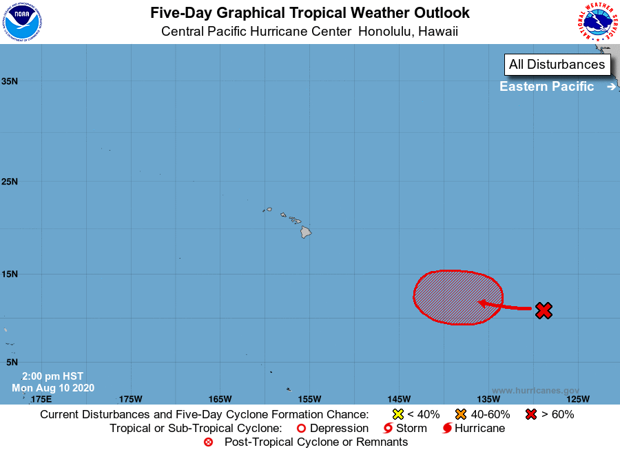
For the central North Pacific...between 140W and 180W:

1. Disorganized showers and thunderstorms associated with a trough of 
low pressure are located about 1850 miles southeast of Hilo, Hawaii. 
An area of low pressure is expected to form from this system in a 
couple of days, and it could become a tropical depression late this 
week. The system is expected to move slowly westward toward the 
Central Pacific basin during the next several days.
* Formation chance through 48 hours...low...20 percent.
* Formation chance through 5 days...high...70 percent.

Elsewhere, no tropical cyclones are expected during the next 5 days.

Forecaster Blood


List of Atlantic Outlooks (May 2023 - present)
List of East Pacific Outlooks (May 2023 - present)
List of Central Pacific Outlooks (May 2023 - present)
List of Atlantic Outlooks (July 2014 - April 2023)
List of East Pacific Outlooks (July 2014 - April 2023)
List of Central Pacific Outlooks (June 2019 - April 2023)
List of Atlantic Outlooks (June 2009 - June 2014)
List of East Pacific Outlooks (June 2009 - June 2014)