ZCZC MIATWOAT ALL
TTAA00 KNHC DDHHMM
Tropical Weather Outlook
NWS National Hurricane Center Miami FL
700 PM EST Tue Nov 8 2022
For the North Atlantic...Caribbean Sea and the Gulf of Mexico:
Active Systems:
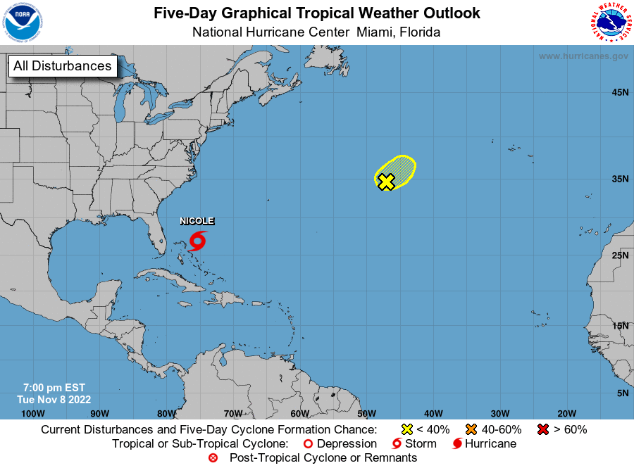
The National Hurricane Center is issuing advisories on Tropical
Storm Nicole, located a couple hundred miles northeast of the
Northwestern Bahamas.
1. Central Subtropical Atlantic:
Shower activity associated with an area of low pressure located
about 950 miles west-southwest of the westernmost Azores Islands
has decreased this evening, and the surface circulation has
become considerably less defined. Upper-level winds are not
conducive for significant development, and the low is expected to
merge with a cold front on Wednesday. Additional information on
this system can be found in High Seas Forecasts issued by the
National Weather Service.
* Formation chance through 48 hours...low...20 percent.
* Formation chance through 5 days...low...20 percent.
High Seas Forecasts issued by the National Weather Service
can be found under AWIPS header NFDHSFAT1, WMO header FZNT01
KWBC, and online at ocean.weather.gov/shtml/NFDHSFAT1.php
Forecaster Roberts