ZCZC MIATWOAT ALL
TTAA00 KNHC DDHHMM
Tropical Weather Outlook
NWS National Hurricane Center Miami FL
700 AM EST Tue Nov 8 2022
For the North Atlantic...Caribbean Sea and the Gulf of Mexico:
Active Systems:
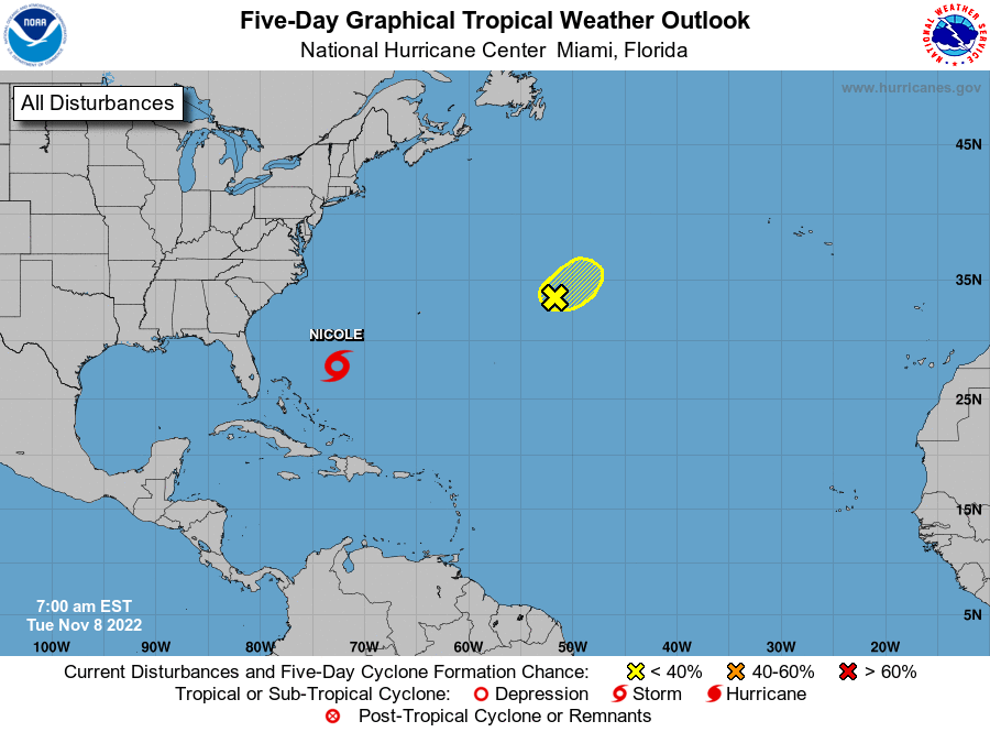
The National Hurricane Center is issuing advisories on Subtropical
Storm Nicole, located over the southwestern Atlantic.
1. Central Subtropical Atlantic:
An area of low pressure located about 750 miles east of Bermuda is
producing disorganized showers and thunderstorms to the east of the
surface center. The system is accelerating northeastward toward
cooler waters, while remaining in a region of strong upper-level
winds. Consequently, the chance for significant development is
diminishing. Additional information on this system can be found in
High Seas Forecasts issued by the National Weather Service.
* Formation chance through 48 hours...low...30 percent.
* Formation chance through 5 days...low...30 percent.
High Seas Forecasts issued by the National Weather Service
can be found under AWIPS header NFDHSFAT1, WMO header FZNT01
KWBC, and online at ocean.weather.gov/shtml/NFDHSFAT1.php
Forecaster Beven