ZCZC MIATWOAT ALL
TTAA00 KNHC DDHHMM
Tropical Weather Outlook
NWS National Hurricane Center Miami FL
800 PM EDT Fri Oct 14 2022
For the North Atlantic...Caribbean Sea and the Gulf of Mexico:
Active Systems:
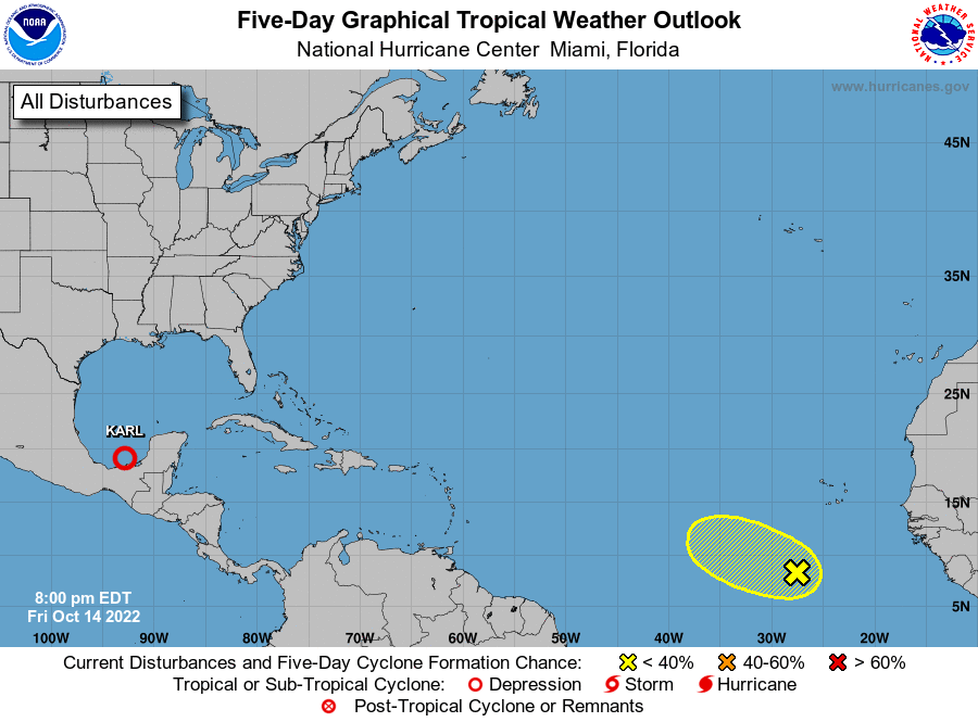
The National Hurricane Center is issuing advisories on Tropical
Storm Karl, located over the Bay of Campeche.
1. Eastern Tropical Atlantic:
A tropical wave is producing a large area of cloudiness and showers
several hundred miles southwest of the Cabo Verde Islands, but that
activity is not showing any signs of organization. Upper-level
winds are expected to increase over the system during the weekend,
therefore significant development is not anticipated while the wave
moves westward or west-northwestward at about 10 mph.
* Formation chance through 48 hours...low...10 percent.
* Formation chance through 5 days...low...10 percent.
Forecaster Berg