ZCZC MIATWOAT ALL
TTAA00 KNHC DDHHMM
Tropical Weather Outlook
NWS National Hurricane Center Miami FL
200 AM EDT Sat Oct 1 2022
For the North Atlantic...Caribbean Sea and the Gulf of Mexico:
Active Systems:
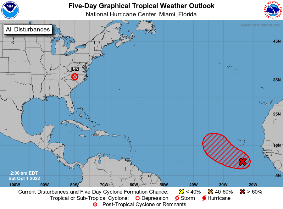
The National Hurricane Center is issuing advisories on Post-Tropical
Cyclone Ian, located inland over North Carolina.
1. Eastern Tropical Atlantic:
A tropical wave is producing disorganized showers and thunderstorms
several hundred miles south of the Cabo Verde Islands.
Environmental conditions are forecast to be conducive for gradual
development of this system, and a tropical depression is likely to
form during the early to middle part of next week while it moves
westward and then northwestward at 5 to 10 mph over the eastern
tropical Atlantic.
* Formation chance through 48 hours...low...20 percent.
* Formation chance through 5 days...high...70 percent.
Forecaster Berg