ZCZC MIATWOAT ALL
TTAA00 KNHC DDHHMM
Tropical Weather Outlook
NWS National Hurricane Center Miami FL
200 PM EDT Sun Sep 25 2022
For the North Atlantic...Caribbean Sea and the Gulf of Mexico:
Active Systems:
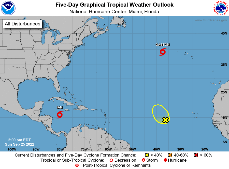
The National Hurricane Center is issuing advisories on Tropical
Storm Ian, located over the western Caribbean Sea, on Tropical Storm
Gaston, located a few hundred miles west of the western Azores.
1. Central Tropical Atlantic:
An area of low pressure located several hundred miles west of the
Cabo Verde Islands continues to produce disorganized shower and
thunderstorm activity. Despite the proximity of nearby dry air,
upper-level winds appear to be generally conducive and could
support some gradual development through the middle to latter
portion of this week as the system moves slowly northward.
* Formation chance through 48 hours...low...20 percent.
* Formation chance through 5 days...low...30 percent.
Forecaster Papin