ZCZC MIATWOAT ALL
TTAA00 KNHC DDHHMM
Tropical Weather Outlook
NWS National Hurricane Center Miami FL
800 AM EDT Sun Sep 4 2022
For the North Atlantic...Caribbean Sea and the Gulf of Mexico:
Active Systems:
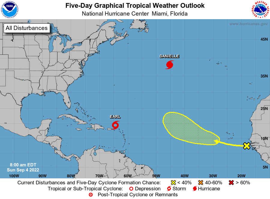
The National Hurricane Center is issuing advisories on
Hurricane Danielle, located about 1000 miles west of the Azores,
and on Tropical Storm Earl, located about 75 miles north of the
Virgin Islands.
1. Eastern Tropical Atlantic:
A tropical wave located just off the African coast is associated
with some disorganized showers and thunderstorms. An area of low
pressure could form later this week and subsequent gradual
development is possible as this system moves generally
west-northwestward over the east-central tropical Atlantic.
* Formation chance through 48 hours...low...near 0 percent.
* Formation chance through 5 days...low...20 percent.
Forecaster Papin