ZCZC MIATWOAT ALL
TTAA00 KNHC DDHHMM
Tropical Weather Outlook
NWS National Hurricane Center Miami FL
200 PM EDT Thu Aug 18 2022
For the North Atlantic...Caribbean Sea and the Gulf of Mexico:
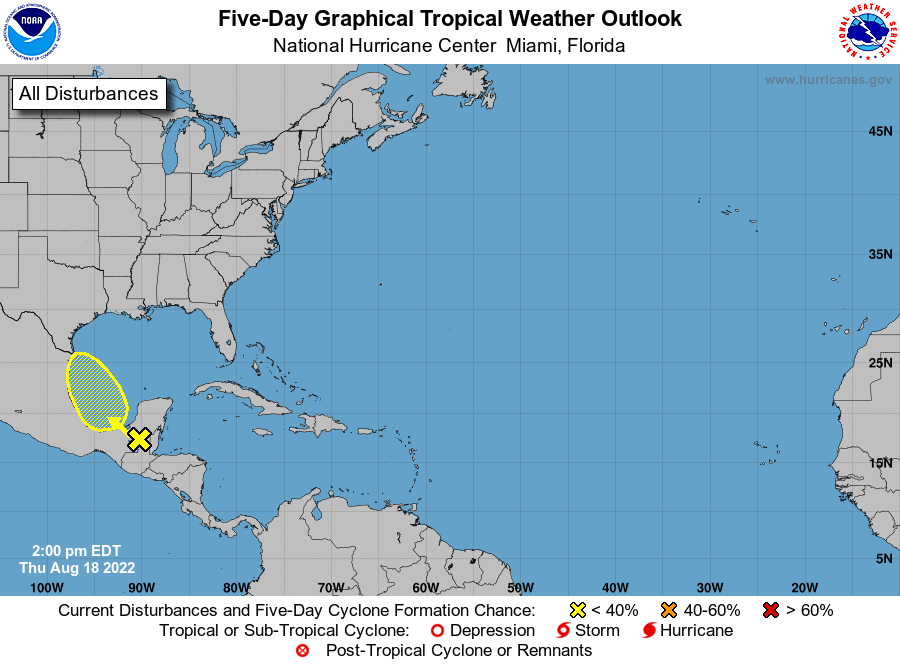
1. Southwestern Gulf of Mexico:
Showers and thunderstorms associated with a tropical wave located
over northern Guatemala and southeastern Mexico have become a little
better organized since yesterday. This system is forecast to emerge
into the Bay of Campeche tomorrow, where an area of low pressure
could form. After that, additional slow development of this system
is possible while it moves northwestward over the southwestern Gulf
of Mexico. By Saturday night, the system is expected to move
inland over northeastern Mexico. An Air Force Reserve Hurricane
Hunter aircraft is scheduled to investigate the system on Friday,
if necessary.
* Formation chance through 48 hours...low...30 percent.
* Formation chance through 5 days...low...30 percent.
Forecaster Beven