ZCZC MIATWOAT ALL
TTAA00 KNHC DDHHMM
Tropical Weather Outlook
NWS National Hurricane Center Miami FL
800 AM EDT Sun Jul 10 2022
For the North Atlantic...Caribbean Sea and the Gulf of Mexico:
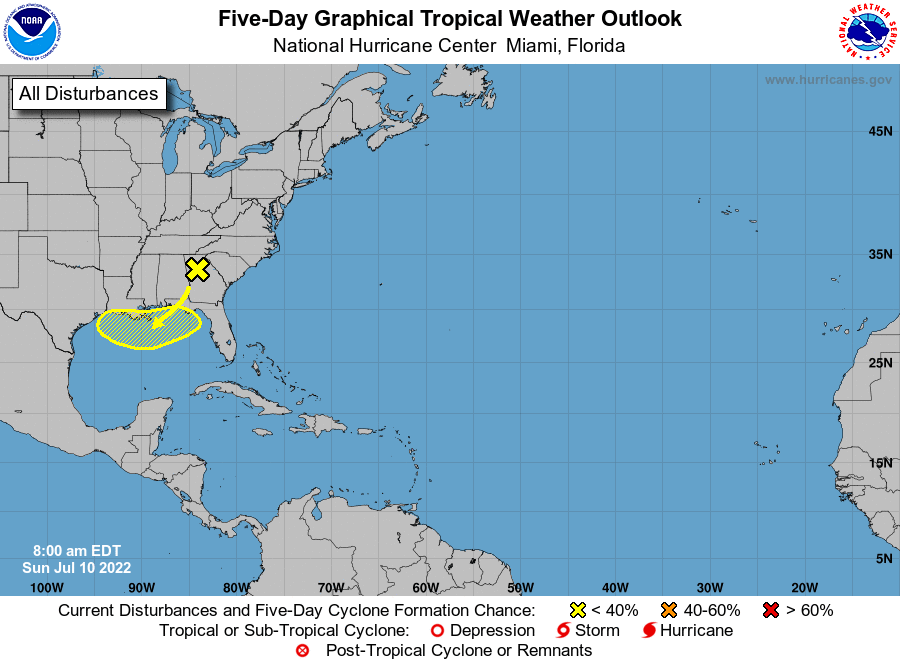
1. Northern Gulf of Mexico:
A surface trough of low pressure is expected to develop in the
northern Gulf of Mexico from a decaying frontal boundary currently
located over the southeastern United States. Any development of
this system is expected to be slow to occur while it drifts just
offshore of the northern Gulf of Mexico coastline through the middle
to later part of this week. Regardless of development, heavy rains
will be possible along portions of the northern Gulf coastline from
Louisiana to the Florida Panhandle over the next several days. For
more information about the potential for heavy rain, please see
products issued by your local National Weather Service Office.
* Formation chance through 48 hours...low...near 0 percent.
* Formation change through 5 days...low...20 percent.
Forecaster Papin