ZCZC MIATWOAT ALL
TTAA00 KNHC DDHHMM
Tropical Weather Outlook
NWS National Hurricane Center Miami FL
200 AM EDT Thu Jun 16 2022
For the North Atlantic...Caribbean Sea and the Gulf of Mexico:
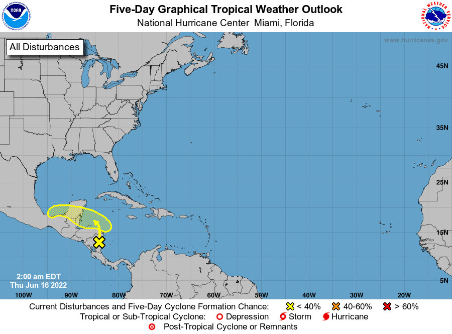
1. Southwestern Caribbean Sea:
An area of low pressure located inland over northeastern Nicaragua
is accompanied by a disorganized area of showers and thunderstorms.
Additional development is unlikely today while the low remains
inland. The system is forecast to move slowly northwestward and
could emerge over the Gulf of Honduras where some development is
possible by Friday. Some development is also possible over the
southern Bay of Campeche by early next week. Regardless of
development, locally heavy rainfall is possible over Nicaragua,
Honduras, Belize, and southeastern Mexico through the weekend.
* Formation chance through 48 hours...low...10 percent.
* Formation chance through 5 days...low...20 percent.
Forecaster Beven