ZCZC MIATWOAT ALL
TTAA00 KNHC DDHHMM
Tropical Weather Outlook
NWS National Hurricane Center Miami FL
800 PM EDT Sun Oct 31 2021
For the North Atlantic...Caribbean Sea and the Gulf of Mexico:
The National Hurricane Center is issuing advisories on Subtropical
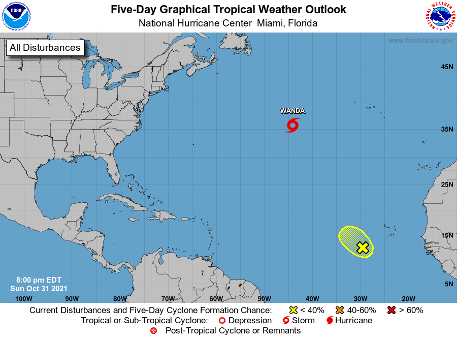
Storm Wanda, located about 900 miles west of the Azores.
1. Disorganized showers and a few thunderstorms continue in association
with a broad area of low pressure located over the tropical eastern
Atlantic, several hundred miles southwest of the Cabo Verde Islands.
Some slow development of this disturbance is possible during the
next day or so while it moves west-northwestward to northwestward at
10 to 15 mph. By Tuesday, the system is forecast to move into a
region of strong upper-level winds and further development is not
expected.
* Formation chance through 48 hours...low...30 percent.
* Formation chance through 5 days...low...30 percent.
Public Advisories on Subtropical Storm Wanda are issued under WMO
header WTNT31 KNHC and under AWIPS header MIATCPAT1.
Forecast/Advisories on Subtropical Storm Wanda are issued under WMO
header WTNT21 KNHC and under AWIPS header MIATCMAT1.
Forecaster Reinhart