ZCZC MIATWOAT ALL
TTAA00 KNHC DDHHMM
Tropical Weather Outlook
NWS National Hurricane Center Miami FL
800 PM EDT Thu Oct 14 2021
For the North Atlantic...Caribbean Sea and the Gulf of Mexico:
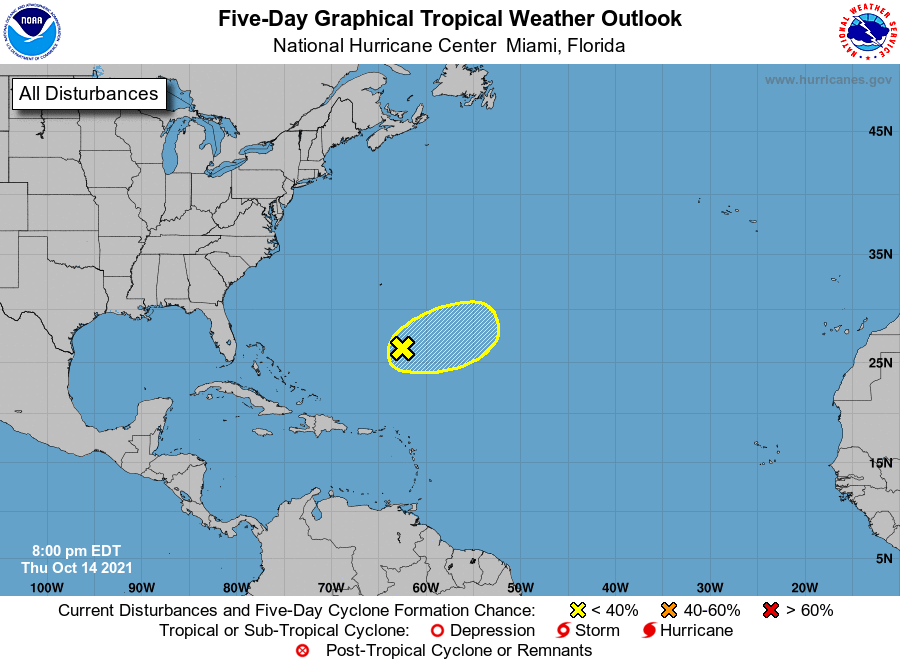
1. An elongated area of low pressure located several hundred miles
south-southeast of Bermuda continues to produce a large area of
disorganized cloudiness and thunderstorms primarily well east of
its center. Strong upper-level winds are expected to prevent
significant development of this system through early Friday. After
that time, the system is forecast to accelerate to the east-
northeast and merge with a trough of low pressure ending any further
tropical development chance. Additional information on this
system, including gale warnings, can be found in High Seas Forecasts
issued by the National Weather Service.
* Formation chance through 48 hours...low...10 percent.
* Formation chance through 5 days...low...10 percent.
High Seas Forecasts issued by the National Weather Service
can be found under AWIPS header NFDHSFAT1, WMO header FZNT01
KWBC, and online at ocean.weather.gov/shtml/NFDHSFAT1.php
Forecaster Brown