ZCZC MIATWOAT ALL
TTAA00 KNHC DDHHMM
Tropical Weather Outlook
NWS National Hurricane Center Miami FL
800 PM EDT Tue Oct 5 2021
For the North Atlantic...Caribbean Sea and the Gulf of Mexico:
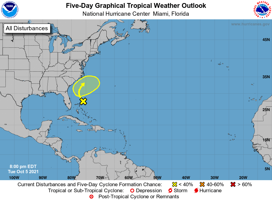
1. Disorganized showers and thunderstorms continue in association with
a surface trough centered about 100 miles northeast of the
northwestern Bahamas. Upper-level winds are expected to remain
unfavorable for significant tropical development of this system
while it moves slowly northwestward over the next few days.
Although upper-level winds could become a little less hostile by the
weekend, the system is forecast to interact with a front near the
coast of the southeastern United States around that time, and
tropical development still appears unlikely.
* Formation chance through 48 hours...low...near 0 percent.
* Formation chance through 5 days...low...10 percent.
Forecaster Cangialosi