ZCZC MIATWOAT ALL
TTAA00 KNHC DDHHMM
Tropical Weather Outlook
NWS National Hurricane Center Miami FL
200 AM EDT Sun Sep 19 2021
For the North Atlantic...Caribbean Sea and the Gulf of Mexico:
The National Hurricane Center is issuing advisories on newly formed
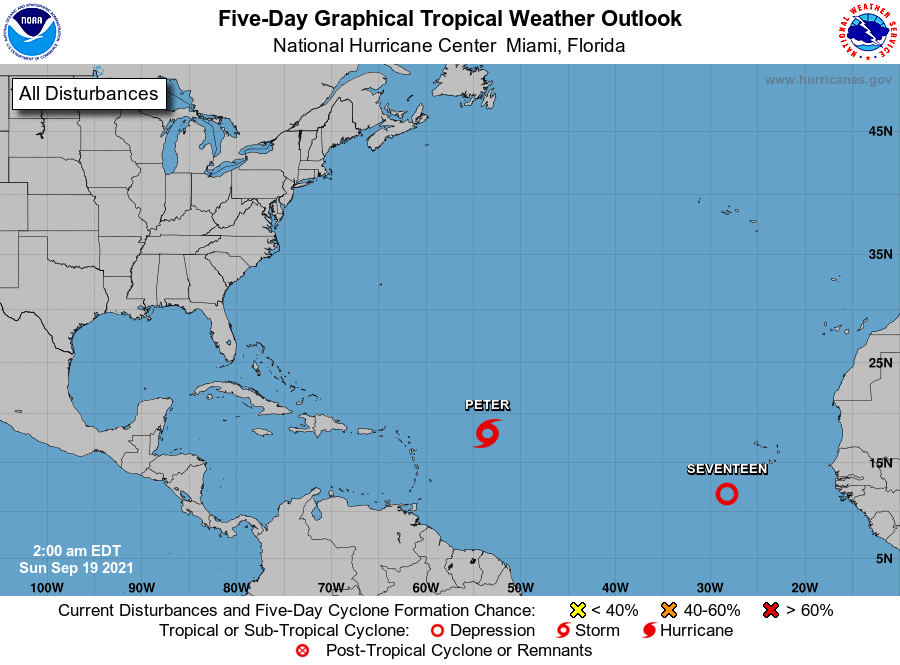
Tropical Depression Sixteen, located a several hundred miles east of
the northern Leeward Island.
1. Recent satellite-derived wind data indicate that the small low
pressure system located over the far eastern tropical Atlantic a few
hundred miles south-southwest of the Cabo Verde Islands has become
better defined. Associated thunderstorm activity has also become
more concentrated near the center, and environmental conditions are
conducive for a tropical depression to form later this morning while
the low moves generally northwestward at 10 to 15 mph, well to the
west of the Cabo Verde Islands.
* Formation chance through 48 hours...high...90 percent.
* Formation chance through 5 days...high...90 percent.
Public Advisories on Tropical Depression Sixteen are issued under
WMO header WTNT31 KNHC and under AWIPS header MIATCPAT1.
Forecast/Advisories on Tropical Depression Sixteen are issued under
WMO header WTNT21 KNHC and under AWIPS header MIATCMAT1.
Forecaster Stewart