ZCZC MIATWOAT ALL
TTAA00 KNHC DDHHMM
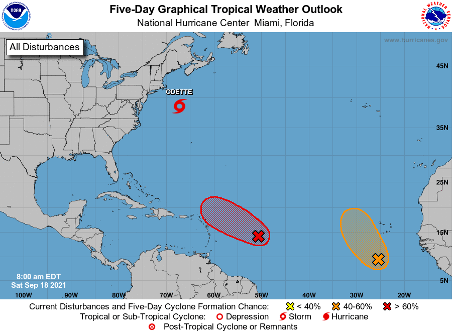
Tropical Weather Outlook
NWS National Hurricane Center Miami FL
800 AM EDT Sat Sep 18 2021
For the North Atlantic...Caribbean Sea and the Gulf of Mexico:
The National Hurricane Center is issuing advisories on Tropical
Storm Odette, located a couple of hundred miles south-southeast of
Nantucket, Massachusetts.
1. Showers and thunderstorms continue to become better organized in
association with an area of low pressure located about 650 miles
miles east-southeast of the northern Leeward Islands.
Environmental conditions are expected to be conducive for further
development during the next day or two, and a tropical depression
or tropical storm is expected to form later today or tonight while
the system moves toward the west-northwest at about 15 mph. This
system is expected to be near the northern Leeward Islands on
Monday and Tuesday, and interests there should monitor its progress.
Upper-level winds are likely to become less conducive for
development when the system reaches the southwestern Atlantic by the
early to middle part of next week. Additional information on this
system, including gale warnings, can be found in High Seas Forecasts
issued by the National Weather Service.
* Formation chance through 48 hours...high...90 percent.
* Formation chance through 5 days...high...90 percent.
2. A broad area of low pressure is located over the far eastern
Atlantic a few hundred miles south of the Cabo Verde Islands. The
associated shower and thunderstorm activity has become a little
better organized since yesterday, and environmental conditions
appear conducive for further development during the next couple of
days. A tropical depression could form while the system moves
northwestward at about 10 mph to the west of the Cabo Verde
Islands before it reaches cooler waters and stronger upper-level
winds early next week.
* Formation chance through 48 hours...medium...40 percent.
* Formation chance through 5 days...medium...40 percent.
Public Advisories on Tropical Storm Odette are issued under
WMO header WTNT35 KNHC and under AWIPS header MIATCPAT5.
Forecast/Advisories on Tropical Storm Odette are issued under
WMO header WTNT25 KNHC and under AWIPS header MIATCMAT5.
High Seas Forecasts issued by the National Weather Service
can be found under AWIPS header NFDHSFAT1, WMO header FZNT01
KWBC, and online at ocean.weather.gov/shtml/NFDHSFAT1.php
Forecaster Berg