ZCZC MIATWOAT ALL
TTAA00 KNHC DDHHMM
Tropical Weather Outlook
NWS National Hurricane Center Miami FL
800 PM EDT Thu Aug 12 2021
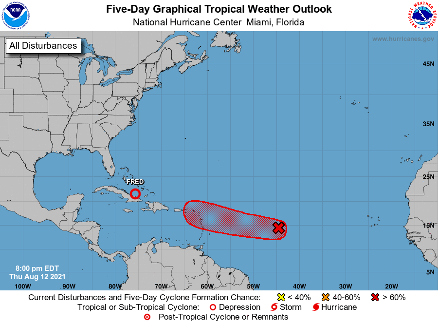
For the North Atlantic...Caribbean Sea and the Gulf of Mexico:
The National Hurricane Center is issuing advisories on Tropical
Depression Fred, located about 240 miles southeast of southern
Andros Island, Bahamas.
1. A small low pressure system located about 1100 miles east of the
Lesser Antilles is producing disorganized shower and thunderstorm
activity primarily west of the center. However, environmental
conditions are expected to gradually become more conducive for
additional development, and a tropical depression is likely to form
by the weekend. The system is forecast to move generally westward at
about 20 mph across the tropical Atlantic, reaching portions of the
Leeward Islands late Saturday or early Sunday, and interests there
should monitor its progress.
* Formation chance through 48 hours...high...70 percent.
* Formation chance through 5 days...high...70 percent.
Forecaster Stewart/Papin