ZCZC MIATWOAT ALL
TTAA00 KNHC DDHHMM
Tropical Weather Outlook
NWS National Hurricane Center Miami FL
800 PM EDT Thu Aug 5 2021
For the North Atlantic...Caribbean Sea and the Gulf of Mexico:
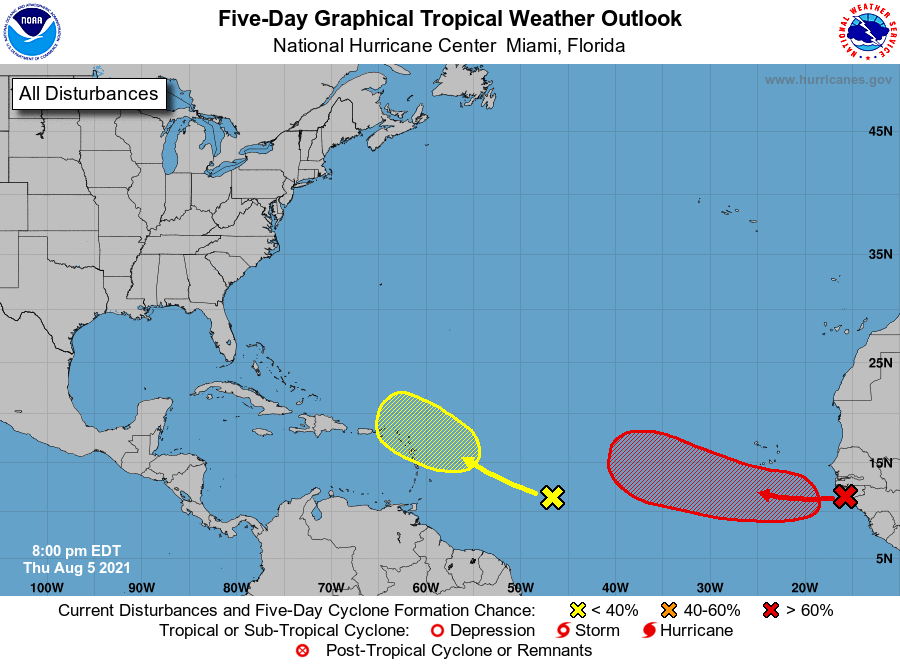
1. A large area of disorganized showers and thunderstorms over western
Africa and the far eastern tropical Atlantic is associated with a
tropical wave. Environmental conditions appear somewhat conducive
for gradual development, and a tropical depression is likely to form
this weekend or early next week while the system moves generally
west-northwestward across the eastern tropical Atlantic.
* Formation chance through 48 hours...medium...40 percent.
* Formation chance through 5 days...high...70 percent.
2. A tropical wave located over the central tropical Atlantic continues
to produce some disorganized showers and thunderstorms. This system
is expected to move west-northwestward at 10 to 15 mph, and some
slow development is possible early next week when it is expected to
be near the Lesser Antilles.
* Formation chance through 48 hours...low...near 0 percent.
* Formation chance through 5 days...low...20 percent.
Forecaster Cangialosi