ZCZC MIATWOAT ALL
TTAA00 KNHC DDHHMM
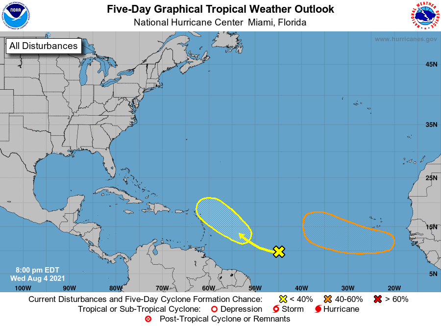
Tropical Weather Outlook
NWS National Hurricane Center Miami FL
800 PM EDT Wed Aug 4 2021
For the North Atlantic...Caribbean Sea and the Gulf of Mexico:
1. A tropical wave located over the central tropical Atlantic is
producing a broad area of disorganized showers and thunderstorms.
Environmental conditions are expected to be marginally conducive for
some slow development east of the Lesser Antilles by Sunday and into
early next week while the disturbance moves west-northwestward at 10
to 15 mph.
* Formation chance through 48 hours...low...near 0 percent.
* Formation chance through 5 days...low...20 percent.
2. A tropical wave is forecast to move off the west coast of Africa
by late Thursday. Environmental conditions appear somewhat
conducive for gradual development thereafter over the eastern
tropical Atlantic through the weekend into early next week while the
system moves westward to west-northwestward at about 15 mph.
* Formation chance through 48 hours...low...near 0 percent.
* Formation chance through 5 days...medium...40 percent.
Forecaster Pasch