ZCZC MIATWOAT ALL
TTAA00 KNHC DDHHMM
Tropical Weather Outlook
NWS National Hurricane Center Miami FL
200 AM EDT Sat Jul 24 2021
For the North Atlantic...Caribbean Sea and the Gulf of Mexico:
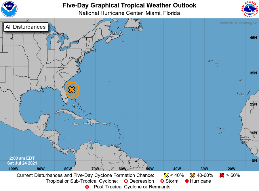
1. Satellite data indicate that the low pressure system located about
150 miles east of Daytona Beach, Florida, remains elongated and not
well defined. In addition, showers and thunderstorms are currently
limited near the low. However, environmental conditions are
expected to become a little more favorable for development, and a
tropical depression could form during the next day or two while the
low meanders offshore or near the Florida peninsula. Interests in
Florida should monitor the progress of this system.
* Formation chance through 48 hours...medium...50 percent.
* Formation chance through 5 days...medium...50 percent.
Forecaster Cangialosi