ZCZC MIATWOAT ALL
TTAA00 KNHC DDHHMM
Tropical Weather Outlook
NWS National Hurricane Center Miami FL
200 PM EDT Mon Jun 28 2021
For the North Atlantic...Caribbean Sea and the Gulf of Mexico:
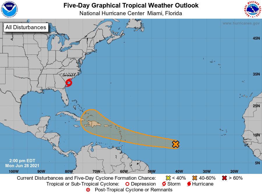
The National Hurricane Center is issuing advisories on newly formed
Tropical Depression Four, located less than 100 miles east-southeast
of Beaufort, South Carolina.
1. A tropical wave located over the central tropical Atlantic Ocean is
producing disorganized showers and a few thunderstorms. Some slow
development of this disturbance is possible after the middle of the
week while the system moves westward to west-northwestward at 15 to
20 mph, likely reaching the Lesser Antilles by Wednesday night.
* Formation chance through 48 hours...low...20 percent.
* Formation chance through 5 days...medium...40 percent.
Public Advisories on Tropical Depression Four are issued under
WMO header WTNT34 KNHC and under AWIPS header MIATCPAT4.
Forecast/Advisories on Tropical Depression Four are issued under
WMO header WTNT24 KNHC and under AWIPS header MIATCMAT4.
Forecaster Stewart/Papin