ZCZC MIATWOAT ALL
TTAA00 KNHC DDHHMM
Tropical Weather Outlook
NWS National Hurricane Center Miami FL
200 PM EDT Wed Jun 23 2021
For the North Atlantic...Caribbean Sea and the Gulf of Mexico:
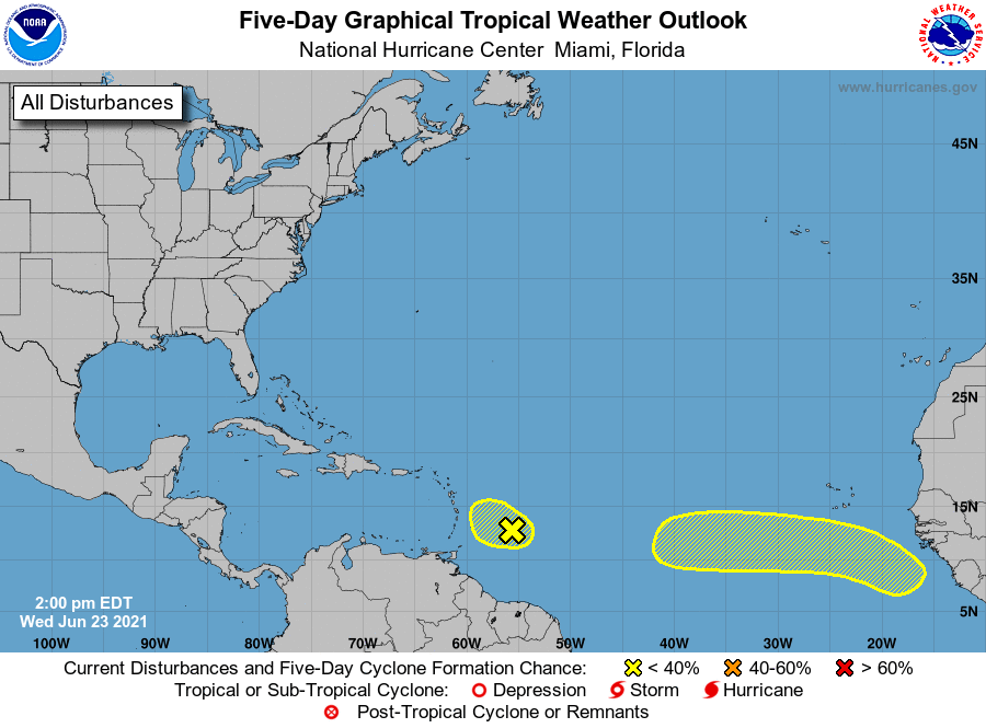
1. Recent visible satellite imagery indicates a weak area of low
pressure has formed along a tropical wave located a few hundred
miles east of the Windward Islands. However, shower and thunderstorm
activity associated with this low is limited. Increasing upper-level
winds are likely to prevent further development of this system as it
moves west-northwestward at 5 to 10 mph.
* Formation chance through 48 hours...low...10 percent.
* Formation chance through 5 days...low...10 percent.
2. A strong tropical wave is expected to emerge off the coast of
Africa over the next day or so. Some gradual development of this
system is possible by early next week while moving generally
westward over the far eastern Atlantic.
* Formation chance through 48 hours...low...near 0 percent.
* Formation chance through 5 days...low...20 percent.
Forecaster Papin/Cangialosi