ZCZC MIATWOAT ALL
TTAA00 KNHC DDHHMM
Tropical Weather Outlook
NWS National Hurricane Center Miami FL
100 PM EST Mon Nov 30 2020
For the North Atlantic...Caribbean Sea and the Gulf of Mexico:
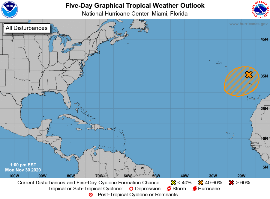
1. A large non-tropical low pressure system centered north of the
Madeira Islands is producing gale-force winds in addition to a broad
region of showers and thunderstorms. This low has changed little in
organization over the last 24 hours, but it could still acquire
subtropical characteristics as it drifts slowly southwestward over
the next day or two. Afterwards, environmental conditions are
forecast to become unfavorable for further development. Regardless
of subtropical development, this system will continue to produce
strong winds and locally heavy rains in the Madeira Islands through
Tuesday. Additional information on this system can be found in High
Seas Forecasts issued by Meteo France.
* Formation chance through 48 hours...medium...40 percent.
* Formation chance through 5 days...medium...40 percent.
High Seas Forecasts issued by Meteo France can be found under WMO
header FQNT50 LFPW.
Forecaster Papin/Berg