ZCZC MIATWOAT ALL
TTAA00 KNHC DDHHMM
Tropical Weather Outlook
NWS National Hurricane Center Miami FL
700 PM EST Sat Nov 21 2020
For the North Atlantic...Caribbean Sea and the Gulf of Mexico:
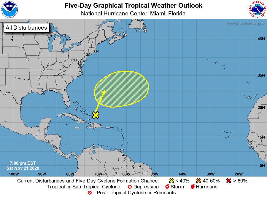
1. A broad trough of low pressure located near and north of the Turks
and Caicos Islands is producing disorganized showers and
thunderstorms. A low pressure area could form within the next couple
of days as the trough lifts northward, and there is a slight chance
it could briefly acquire subtropical characteristics early next week
before merging with a cold front. Later next week, this system may
have a second opportunity to develop subtropical characteristics if
it becomes separated from the front and meanders over the central
Atlantic.
* Formation chance through 48 hours...low...10 percent.
* Formation chance through 5 days...low...10 percent.
Forecaster Reinhart/Beven