ZCZC MIATWOAT ALL
TTAA00 KNHC DDHHMM
Tropical Weather Outlook
NWS National Hurricane Center Miami FL
800 PM EDT Thu Oct 29 2020
For the North Atlantic...Caribbean Sea and the Gulf of Mexico:
The National Hurricane Center has issued the last advisory on
Post-Tropical Cyclone Zeta, located over the western Atlantic
Ocean off of the coast of the Mid-Atlantic states.
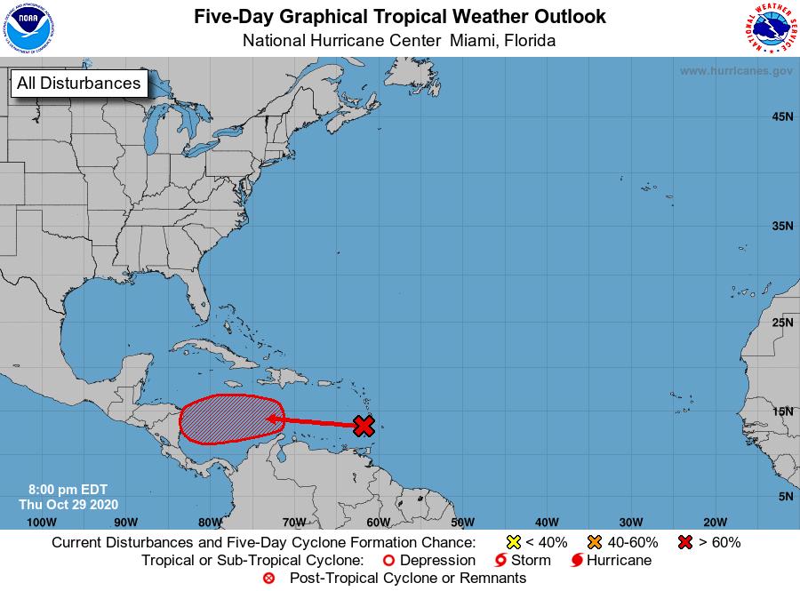
1. A large area of disturbed weather in the vicinity of the Lesser
Antilles is associated with a tropical wave. Upper-level winds are
expected to become more conducive for development of this
disturbance during the next few days, and a tropical depression is
likely to form by the time the system reaches the western Caribbean
Sea early next week.
* Formation chance through 48 hours...low...30 percent.
* Formation chance through 5 days...high...70 percent.
Forecaster Beven