ZCZC MIATWOAT ALL
TTAA00 KNHC DDHHMM
Tropical Weather Outlook
NWS National Hurricane Center Miami FL
200 PM EDT Sun Oct 18 2020
For the North Atlantic...Caribbean Sea and the Gulf of Mexico:
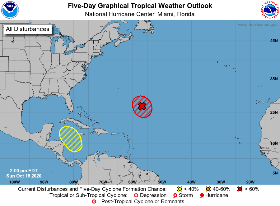
1. Showers and thunderstorm activity associated with a non-tropical
low pressure system located about 600 miles southeast of Bermuda is
poorly organized and displaced well east of the low-level center.
Environmental conditions remain conducive for development, and a
subtropical depression or storm is very likely to form during the
next day or so while the low meanders well to the southeast of
Bermuda.
* Formation chance through 48 hours...high...80 percent.
* Formation chance through 5 days...high...90 percent.
2. A broad area of low pressure is likely to form in a couple of days
over the southwestern Caribbean Sea. Some gradual development of
this system is possible late this week as it moves slowly
northwestward or north-northwestward over the western Caribbean Sea.
* Formation chance through 48 hours...low...near 0 percent.
* Formation chance through 5 days...low...20 percent.
Forecaster Reinhart/Blake