ZCZC MIATWOAT ALL
TTAA00 KNHC DDHHMM
Tropical Weather Outlook
NWS National Hurricane Center Miami FL
800 PM EDT Sat Sep 19 2020
For the North Atlantic...Caribbean Sea and the Gulf of Mexico:
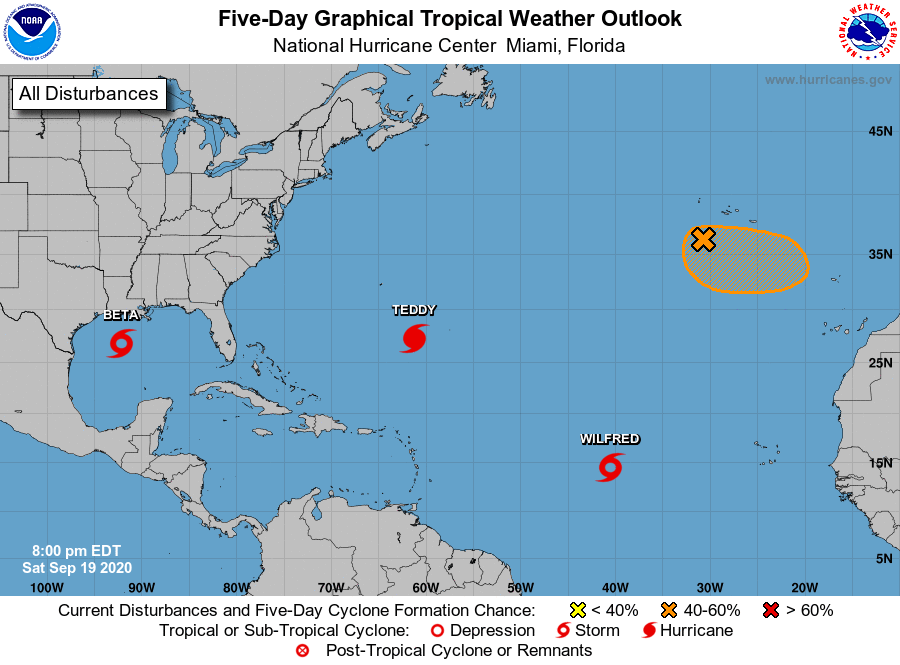
The National Hurricane Center is issuing advisories on Tropical
Storm Beta, located over the western Gulf of Mexico, on Hurricane
Teddy, located over the central Atlantic, and on Tropical Storm
Wilfred, located over the eastern tropical Atlantic.
1. Post-Tropical Cyclone Paulette is located a few hundred miles south
of the Azores and is producing a few showers. This system is
drifting southward over marginally warm waters and is expected to
begin moving eastward in a couple of days. The cyclone could
develop tropical or subtropical characteristics by early next week.
For more information about marine hazards associated with this
system, see High Seas Forecasts issued by Meteo France.
* Formation chance through 48 hours...medium...50 percent.
* Formation chance through 5 days...medium...60 percent.
High Seas Forecasts issued by Meteo France can be found under WMO
header FQNT50 LFPW and available on the web at
www.meteofrance.com/previsions-meteo-marine/bulletin/grandlarge/
metarea2
Forecaster Pasch