Skip Navigation Links
NOAA NOAA United States Department of Commerce

NHC Graphical Outlook Archive


« Earliest Available         ‹ Earlier         Later ›         Latest Available »
GIS Shapefiles
Central Pacific Eastern Pacific Atlantic

View 2-Day Graphical Tropical Weather Outlook
Click for Eastern Pacific Click for Eastern Pacific

Tropical Weather Outlook Text

ZCZC MIATWOAT ALL
TTAA00 KNHC DDHHMM

Tropical Weather Outlook
NWS National Hurricane Center Miami FL
800 PM EDT Wed Aug 5 2020

For the North Atlantic...Caribbean Sea and the Gulf of Mexico:

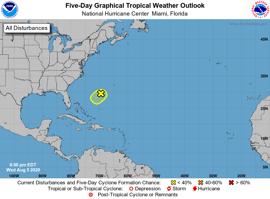
1. A small but well-defined low pressure system located a few hundred 
miles southwest of Bermuda is producing disorganized showers and a 
few thunderstorms.  This low is expected to drift west-southwestward 
during the next couple of days. Any development of this disturbance 
should be slow to occur due to dry air and increasing upper-level 
winds by the weekend.
* Formation chance through 48 hours...low...10 percent.
* Formation chance through 5 days...low...10 percent.

Forecaster Latto


List of Atlantic Outlooks (May 2023 - present)
List of East Pacific Outlooks (May 2023 - present)
List of Central Pacific Outlooks (May 2023 - present)
List of Atlantic Outlooks (July 2014 - April 2023)
List of East Pacific Outlooks (July 2014 - April 2023)
List of Central Pacific Outlooks (June 2019 - April 2023)
List of Atlantic Outlooks (June 2009 - June 2014)
List of East Pacific Outlooks (June 2009 - June 2014)