ZCZC MIATWOAT ALL
TTAA00 KNHC DDHHMM
Tropical Weather Outlook
NWS National Hurricane Center Miami FL
200 PM EDT Tue Aug 4 2020
For the North Atlantic...Caribbean Sea and the Gulf of Mexico:
The National Hurricane Center is issuing advisories on Tropical
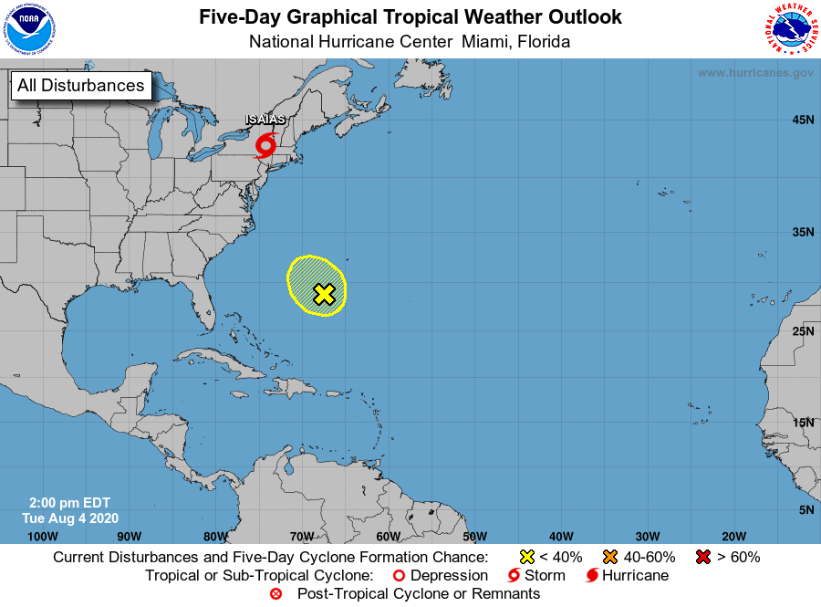
Storm Isaias, located inland over southeastern Pennsylvania.
1. Disorganized showers and thunderstorms continue in association with
a trough of low pressure located a few hundred miles south-southwest
of Bermuda. Although a weak area of low pressure could form during
the next day or so, abundant dry air surrounding the system is
likely to limit significant development. This system is forecast to
move northwestward at about 10 mph over the southwestern Atlantic
and then drift southwestward on Thursday.
* Formation chance through 48 hours...low...20 percent.
* Formation chance through 5 days...low...20 percent.
Forecaster Latto