ZCZC MIATWOAT ALL
TTAA00 KNHC DDHHMM
Tropical Weather Outlook
NWS National Hurricane Center Miami FL
800 PM EDT Mon Aug 3 2020
For the North Atlantic...Caribbean Sea and the Gulf of Mexico:
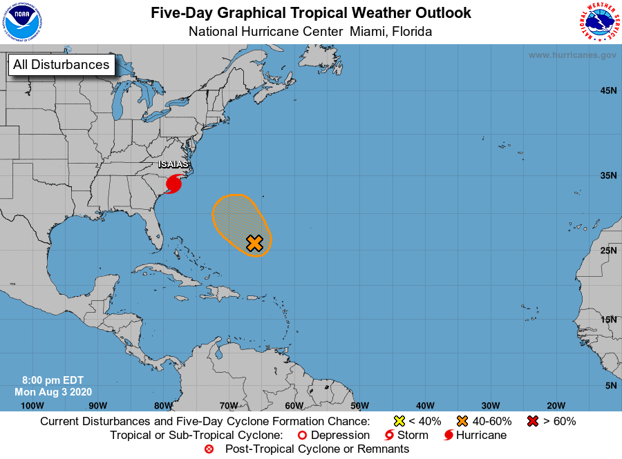
The National Hurricane Center is issuing advisories on Hurricane
Isaias, located just off the coast of South Carolina.
1. A trough of low pressure located a few hundred miles south of
Bermuda continues to produce showers and a few thunderstorms. This
system has shown signs of organization in the mid-levels for the
past couple of days, but it still appears to be disorganized at the
surface. Environmental conditions are forecast to be marginally
conducive for development of this system during the next few days
and a tropical depression could form later this week. This system is
forecast to move northwestward at about 15 mph over the southwestern
Atlantic today and on Tuesday, and then stall several hundred miles
southwest of Bermuda by the middle to latter part of the week.
* Formation chance through 48 hours...medium...40 percent.
* Formation chance through 5 days...medium...50 percent.
Forecaster Zelinsky